
Case Studies

Photo attributed to Michael Oswald. This work has been released into the public domain by its author. No endorsement by licensor implied.
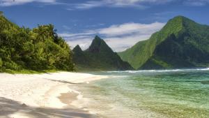
Si'u Point Trail, Ta'u Island, National Park of American Samoa, Department of the Interior, via Flickr. Used via a Creative Commons license, CC BY-SA 2.0, https://creativecommons.org/licenses/by-sa/2.0/
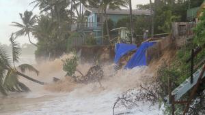
Sunset Beach is slammed by waves when high tide combined with high surf in the winter of 2013–2014. Photo courtesy of the University of Hawai‘i Sea Grant College Program (Hawai‘i Sea Grant).
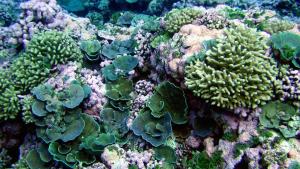
Green and pink reef scene. American Samoa, Swains Island. Image Credit: NOAA Pacific Islands Fisheries Center, Coral Reef Ecosystem Program, Oceanography Team. CC-BY-2.0, https://creativecommons.org/licenses/by/2.0/


This work has been released into the public domain because it contains materials that originally came from the U.S. National Oceanic and Atmospheric Administration. No endorsement by licensor implied.

Photo attributed to Diego Delso, delso.photo. Incorporated here under the terms of the license CC BY-SA. No endorsement by licensor implied.

Demolition of the Washington Post building, 2016. Photo by Victoria Pickering, CC BY-NC-ND 2.0, https://creativecommons.org/licenses/by-nc-nd/2.0/
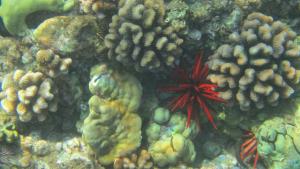
Maui coral reef, by Alfonsin11. CC BY-SA 3.0, http://creativecommons.org/licenses/by-sa/3.0, via Wikimedia Commons
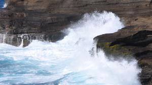
Waves crashing into basaltic rocks formed from lava flows on Hawai'i Island. Courtesy of pxhere.com
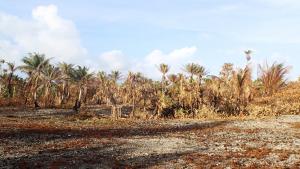
Drought on Ailuk Atoll in 2013, Republic of the Marshall Islands. Unmodified photo by PACC, CC BY-NC-ND 2.0, https://creativecommons.org/licenses/by-nc-nd/2.0/, via Flickr

This image has been released into the public domain because it contains materials that originally came from the National Park Service. No endorsement by licensor implied.
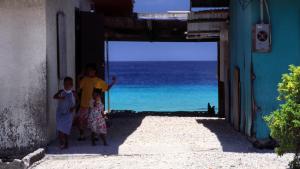
Homes in the Marshall Islands form a natural frame for the sea. Photo by Stefan Lins, CC-BY-2.0, https://creativecommons.org/licenses/by/2.0/, via Flickr.
Splash screen from NFWF Case Study
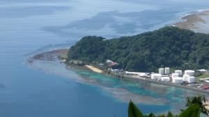
The fuel tanks at the entrance to Pago Pago Harbor. American Samoa, Tutuila Island. Source: LCDR Eric Johnson, NOAA Corps. - NOAA Photo Library