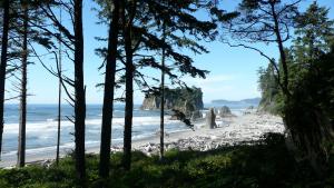
Home
Main navigation
  • Case Studies
    Mega Menu Icon
    Image
    case study icon
    Browse Case Studies
    • Filtered by hazard
      • Drought
      • Extreme Heat
      • Coastal Flooding
      • Flooding
      • Wildfire
    • Filtered by asset
      • Agriculture
      • Community Services
      • Critical Facilities
      • Economy
      • Energy
      • People
      • Property
      • Natural Areas
      • Transportation
      • Water Infrastructure
  • Tools
    Mega Menu Icon
    Image
    data and tools icon
    Browse Tools
    • Filtered by hazard
      • Drought
      • Extreme Heat
      • Coastal Flooding
      • Flooding
      • Wildfire
    • Filtered by asset
      • Agriculture
      • Community Services
      • Critical Facilities
      • Economy
      • Energy
      • People
      • Property
      • Natural Areas
      • Transportation
      • Water Infrastructure
  • Funding
    Mega Menu Icon
    Image
    funding icon
    Browse Funding & Capacity
    • Funding & Building Capacity
    • Search for Funding Opportunities
    • Grant Development Resources
  • Steps to Resilience
    • Overview
    • Get Started
    • Understand Exposure
    • Assess Vulnerability & Risk
    • Investigate Options
    • Prioritize & Plan
    • Take Action
  • Toolkit Contents
    Mega Menu Icon
    Image
    popular resources icon
    Browse Popular Resources
    • Announcements
    • About this Toolkit
    • Steps to Resilience
    • Glossary
    • Contact
    • Tools
    • Help Desk
    • Trainings
    • Options Database
    • New to the Toolkit?
    • Topics & Sectors
    • Regions
    • Hazards
    • Assets

Breadcrumb

  1. Home
Image
Resources for Renewable Energy and Building Energy Efficiency Applications, Part 3
Image
Using NASA Products for a More Climate Resilient Energy Sector, Part 2
Image
Introduction to Earth Observations (EOs) for Energy Management, Part 1

Climate Explorer offers projections for the entire United States

The latest version of the Climate Explorer offers climate projections for every county in the entire United States. The recent addition of climate projection data for Hawai'i and U.S. island territories in the Pacific Ocean and Caribbean Sea complements the tool’s original contiguous U.S (CONUS) coverage and the addition of data for Alaska.

Launch the Climate Explorer Tool

Image
Southeast Regional Partnership for Planning and Sustainability (SERPPAS)
Image
Reef Resilience Network: Community-Based Climate Adaptation
Image
Resilient NJ: Local Planning for Climate Change Toolkit
Image
Ocean at the Door Map: Rising Seas, Real Estate, & Risk
Image
Coastal Risk Screening Tool
Image
SCIPP Temperature Trends Dashboard - Texas, Oklahoma, Arkansas, & Louisiana

Pagination

  • First page « First
  • Previous page ‹ Previous
  • …
  • Page 27
  • Page 28
  • Page 29
  • Page 30
  • Current page 31
  • Page 32
  • Page 33
  • Page 34
  • Page 35
  • …
  • Next page Next ›
  • Last page Last »
Subscribe to
Climate.gov
  • Home
  • News & Features
  • Teaching Climate
  • Maps & Data
  • FAQs
  • Contact
Main Menu
  • About
  • FAQ
  • Contact
  • Acknowledgments
  • Sitemap
Latest
  • Funding Opportunities
  • Glossary
  • Announcements
Partners
  • climate.data.gov
  • climate.gov
  • USA.gov
  • NEMAC
Toolkit
  • Case Studies
  • Tools
  • Funding
  • Steps to Resilience
  • Popular Resources

Image removed.

Required Footer Links
  • NOAA Privacy
  • Accessibility
  • FOIA
  • Information Quality
  • No-FEAR Act
  • Ready.gov
  • USA.gov